The Wonder of Iceland
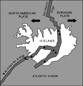
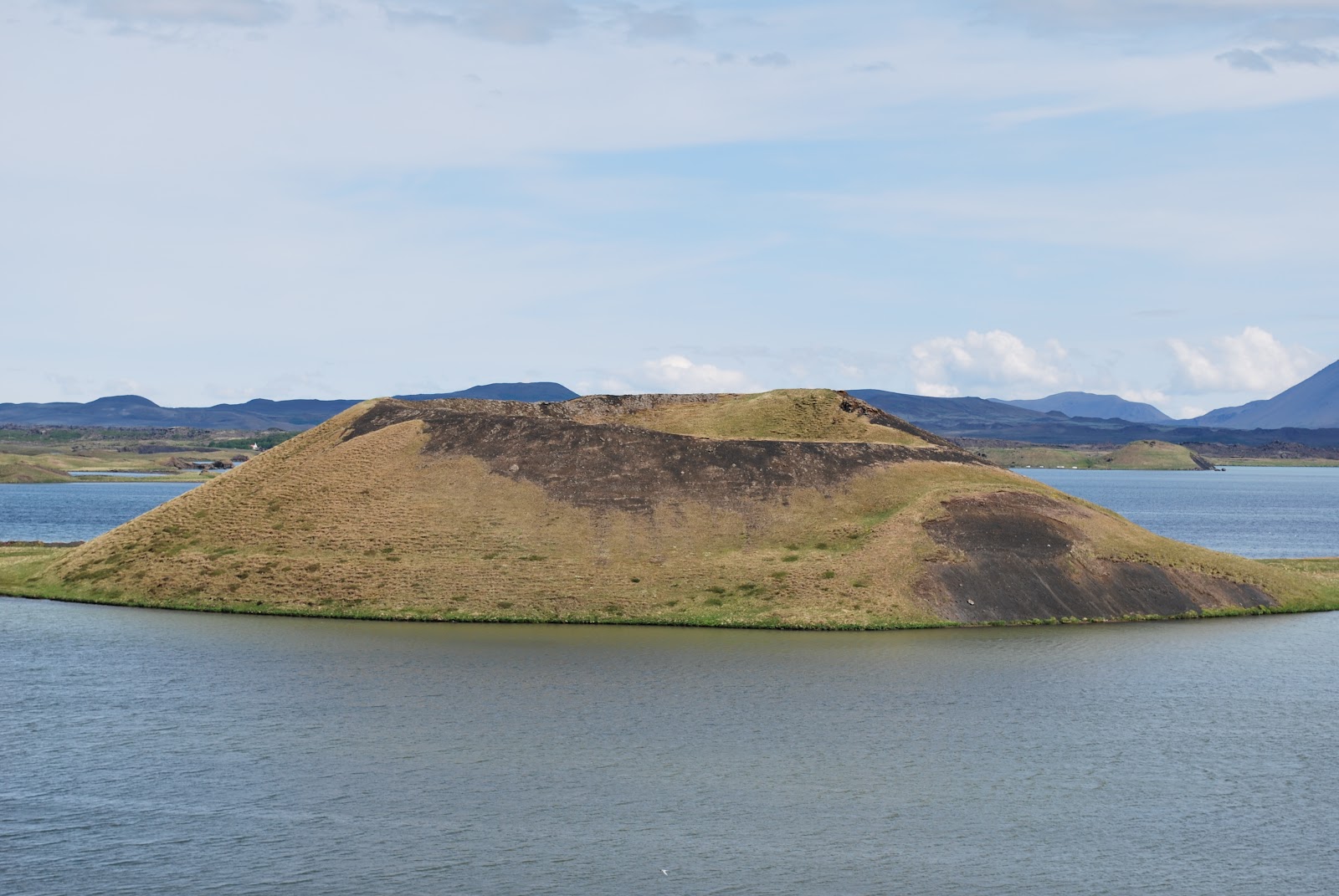
Before explaining what we did after our visit to Myvatn, I have to explain the wonder of Iceland. I found an image on a Tulane University website (a picture worth a thousand words). The island is made of 2 continental tectonic plates (North American and Eurasian) going diagonally from the penninsula at the bottom left of the island (where Reykjavik is) to the top right northeastern corner. This is the Mid-Atlantic Ridge and all along it are examples of volcanic activity (fissures, craters, volcanoes, hot springs, etc). There's a place where you can go scuba diving in between the 2 plates, the water apparently so clear. The land is alive and constantly moving.
The following photos were taken near Lake Myvatn (which is right on the rift). And similar formations are found in Thingvellir nearer to Reykjavik (see photos further down the blog below).


From the Lake Myvatn area, we drove northward toward Husavik.

 |
| Dettifoss |
And guess what we saw along the way...more majestic waterfalls!!
 |
| Dettifoss |
 |
| Hafragilsfoss |
 We drove around more fjords; saw plenty of birds.
We were very very close to the edge of the Arctic. At the end of this peninsula is 66 degrees North, it just kisses the Arctic Circle. The view is from Tjörnes Peninsula looking east across the Oxarfjordur Fjord.
In wintertime this area is THE place to see the Northern Lights, but on the shortest day there is almost total darkness.
Upon our arrival in Husavik, we got the most heartfelt welcome yet from our Hotel!! The Husavik Cape Hotel were flying a Canadian flag. There were 4 flagposts sporting each a French, Spanish, Norwegian and Canadian flag in our honour. It's a new hotel in a renovated building. http://www.husavikhotel.com/

 Husavik is a harbour town. The thing to do in Husavik is go whale watching, so we did and of course we saw my favorite gentle giants, the humpback whale, three in all! Our boat Bjossi Sur - North Sailing.

I didn't pull out the video camera until the very end so this video only shows the same whale in 2 different places diving down without showing its tail or flukes like the other whales we saw. He was also further out. The water was wavy so the boat moved around quite a bit, I only went to our backpack to get the camera when I felt more comfortable on my feet!
Driving from Husavik, we saw yet another waterfall, Godafoss.


We stopped in Akureyri which is the capital of Northern Iceland and the next biggest city after Reykjavik.

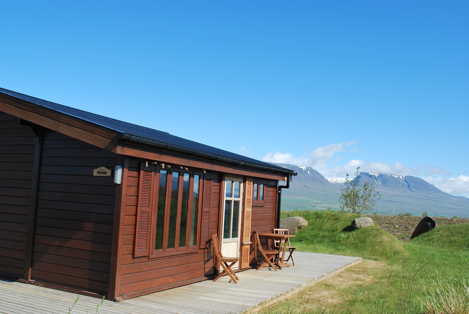
We stayed in a summerhouse with a hot spring tub in the middle of the handful of summerhouses in a town called Varmahlid called Hestasport. http://www.riding.is/cottages
We were nestled in a valley with snowy mountains in the background. Very peaceful. The next morning we left early because we knew we would have a long day's drive.

 One of the last legs of our trip, and what I thought would be the most adventurous and the reason we rented a 4x4 in the first place, was our drive down the F35. The F35 is a long (more than 200km), gravel road between two huge glaciers (Langjokull and Hofsjokull) only open during summer and only accessible by 4x4. This interior area is known as the highlands. I found that our trek down the Road to Thorsmork (Journey versus Destination post) was more adventurous but alas much shorter.
 |
| Signpost showing length of F35 |
 |
| Langjokull (Long Glacier) |


We stopped twice along F35, once in Hveravellir to have a bite and a dip (you have to take all your garbage with you).
Next at lake Hvitarvatn a beautifal glacial lake at the foot of a tongue of the Langjokull glacier with its turquoise colour and all. Breathtaking!


We stopped at Gulfoss (Golden Falls) which is a multi-tiered waterfall and probably the most-visited waterfalls in Iceland. They are very powerful.
Then we stopped at Geysir which is another geothermally active area but with at least one geyser which blows regularly.
Our last accommodations were once again a summerhouse in Uthlid. http://www.uthlid.is/mambo/index.php?option=content&task=view&id=31&Itemid=17 After roaming around the area, we finally found the area where our cottage was, but due to unclear signage, spent about 15-20 minutes roaming around trying to find the reception desk which was actually a restaurant/banquet hall, where we had breakfast the next morning. We spoke to one of the owners to suggest they improve their signage from the main road.
On our last day in Iceland, before heading out to Keflavik airport, we stopped at Thingvellir which is along the Mid-Atlantic Ridge and the place where you can scuba dive in the ridge (see first figure above). Here are some photos of that area that has fissures, cliffs, canyons.

On our last day in Iceland, before heading out to Keflavik airport, we stopped at Thingvellir which is along the Mid-Atlantic Ridge and the place where you can scuba dive in the ridge (see first figure above). Here are some photos of that area that has fissures, cliffs, canyons.

 |
| People can scuba dive in this area |
 |
| The North American side of the rift |
This concludes our Icelandic Itinerary. Hope you enjoyed our photos and videos. While I may post other tidbits about Iceland in the future, this pretty much sums up our trip!